
Farm Ruins in Raven Craig Wood
Introduction
The photograph on this page of Farm Ruins in Raven Craig Wood by Ian Dodds as part of the Geograph project.
The Geograph project started in 2005 with the aim of publishing, organising and preserving representative images for every square kilometre of Great Britain, Ireland and the Isle of Man.

There are currently over 7.5m images from over 14,400 individuals and you can help contribute to the project by visiting https://www.geograph.org.uk
Farm Ruins in Raven Craig Wood
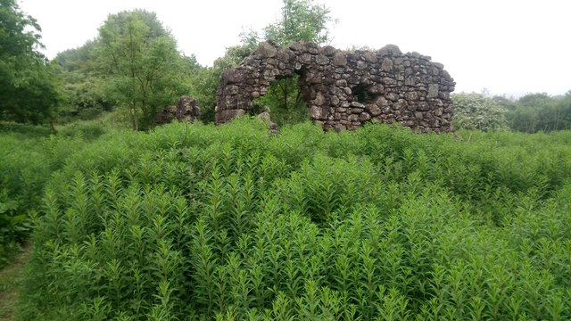
Image: © Ian Dodds Taken: 14 Jun 2020
This used to be a farm called Craigs and is just off one of the main paths in Raven Craig Wood. From looking at old OS maps of the area it looks like it was abandoned at some point in the middle of the 20th Century. Outline of buildings is show on 1960s map, but no name is ascribed, presumably signifying it was no longer occupied. Are further remains behind what is shown in picture though not as substantial.
Images are licensed for reuse under creativecommons.org/licenses/by-sa/2.0
Image Location

Latitude
55.91436
Longitude
-3.60946