Eversfield
Introduction
The photograph on this page of Eversfield by Ian Capper as part of the Geograph project.
The Geograph project started in 2005 with the aim of publishing, organising and preserving representative images for every square kilometre of Great Britain, Ireland and the Isle of Man.

There are currently over 7.5m images from over 14,400 individuals and you can help contribute to the project by visiting https://www.geograph.org.uk
Eversfield
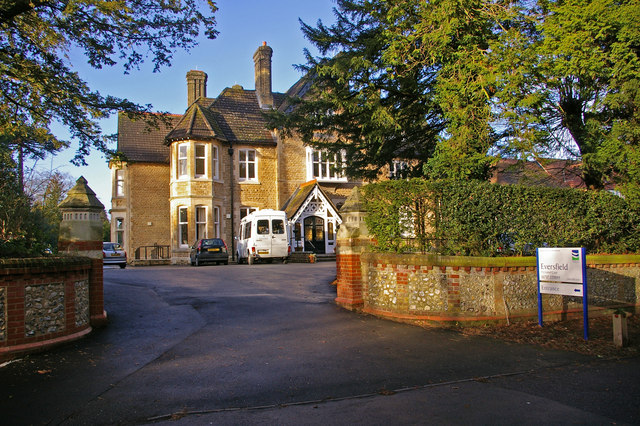
Image: © Ian Capper Taken: 5 Jan 2008
Eversfield is one of a number of large houses built in the late 1800s along the Reigate Road, many of which have now been demolished. Eversfield is now a care home, as was its neighbour Fonthill (situated behind the photographer) for many years (although now proposed for conversion to flats).
Images are licensed for reuse under creativecommons.org/licenses/by-sa/2.0
Image Location


Leaflet Map data © OpenStreetMap
Latitude
51.237253
Longitude
-0.190342