West Howe: Grower Gardens
Introduction
The photograph on this page of West Howe: Grower Gardens by Chris Downer as part of the Geograph project.
The Geograph project started in 2005 with the aim of publishing, organising and preserving representative images for every square kilometre of Great Britain, Ireland and the Isle of Man.

There are currently over 7.5m images from over 14,400 individuals and you can help contribute to the project by visiting https://www.geograph.org.uk
West Howe: Grower Gardens
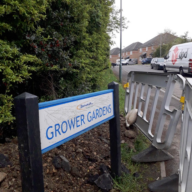
Image: © Chris Downer Taken: 18 Apr 2020
Right by the heart of the large 1950s West Howe council estate, Grower Gardens is one of relatively few roads to have been added to the estate since it was built. Along with Hanlon Close which comes off it, it is built on the site of the old Heathlands First School, which closed in around 1993 when it amalgamated with Heathlands Junior to become an all-through primary school, and was all accommodated on the Junior site. The school buildings were destroyed by fire shortly after closure and before official demolition was due. The sign is a modern one, from 2010-15 when this more modern, abstract emblem rather than the traditional town coat of arms as the working logo of the council. It is currently barricaded in by a small cordon for road works by the gas board. This is photo no.177 of a series of 453 in my coronavirus lockdown walking project: See https://www.geograph.org.uk/article/My-2020-Coronavirus-Lockdown-walking-project for the complete set of photos.
Images are licensed for reuse under creativecommons.org/licenses/by-sa/2.0
Image Location
Latitude
50.760138
Longitude
-1.909494