Old Milepost by the A53, north of Hopton Methodist Chapel
Introduction
The photograph on this page of Old Milepost by the A53, north of Hopton Methodist Chapel by John Haynes as part of the Geograph project.
The Geograph project started in 2005 with the aim of publishing, organising and preserving representative images for every square kilometre of Great Britain, Ireland and the Isle of Man.

There are currently over 7.5m images from over 14,400 individuals and you can help contribute to the project by visiting https://www.geograph.org.uk
Old Milepost by the A53, north of Hopton Methodist Chapel
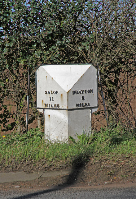
Image: © John Haynes Taken: 16 Mar 2020
Cast iron post by the A53, north of Hopton Methodist Chapel, on west side of road. In parish of HODNET (NORTH SHROPSHIRE District), Salop iron T-post, erected by the County Council in the 19th/20th century. Removed from the east side of road, recovered by the council, and then re-installed on the west side of the road, so the directions are the wrong way round. Inscription reads:- : SALOP / 11 / MILES : : DRAYTON / 8 / MILES : Milestone Society National ID: SA_MDSB08.
Images are licensed for reuse under creativecommons.org/licenses/by-sa/2.0
Image Location
Latitude
52.829493
Longitude
-2.599874