Modern Waymarker west of Stocksmoor
Introduction
The photograph on this page of Modern Waymarker west of Stocksmoor by Jan Scrine as part of the Geograph project.
The Geograph project started in 2005 with the aim of publishing, organising and preserving representative images for every square kilometre of Great Britain, Ireland and the Isle of Man.

There are currently over 7.5m images from over 14,400 individuals and you can help contribute to the project by visiting https://www.geograph.org.uk
Modern Waymarker west of Stocksmoor
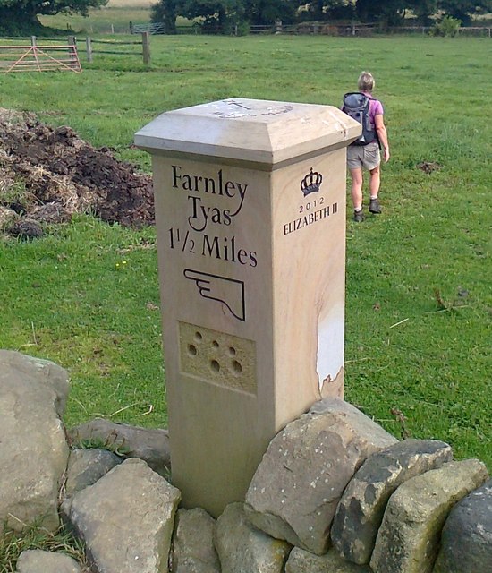
Image: © Jan Scrine Taken: 26 Aug 2013
Dave Bradbury modern carved stone north east of Stocks Lane, in parish of Kirkburton (Kirklees District), by a stone stile. The stone can be found during the Kirkburton Parish Walk - 'Molly Mangle’s Meander'. Inscription reads:- : Farnley Tyas / 1½ Miles / {pointing hand} : : {Crown} / 2012 / ELIZABETH II : To be surveyed Milestone Society National ID: YW_KLN06.
Images are licensed for reuse under creativecommons.org/licenses/by-sa/2.0
Image Location
Latitude
53.591141
Longitude
-1.732709