Pont Tal-y-bont over Afon Cynfal
Introduction
The photograph on this page of Pont Tal-y-bont over Afon Cynfal by Barry Hunter as part of the Geograph project.
The Geograph project started in 2005 with the aim of publishing, organising and preserving representative images for every square kilometre of Great Britain, Ireland and the Isle of Man.

There are currently over 7.5m images from over 14,400 individuals and you can help contribute to the project by visiting https://www.geograph.org.uk
Pont Tal-y-bont over Afon Cynfal
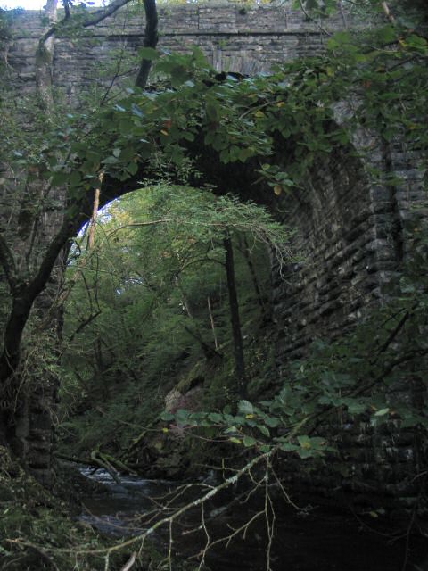
Image: © Barry Hunter Taken: 13 Oct 2005
Seen here is the Afon Cynfal passing under a Road Bridge. The River Cynfal at this point is reaching the end of its journey down Cwm Cynfal and Ceunant Cynfal as it's about to flow into the Afon Dwyryd. The bridge is actually between quite a nasty junction and a sharp bend, and the walls are regularly having to be repaired where drivers have bounced off!
Images are licensed for reuse under creativecommons.org/licenses/by-sa/2.0
Image Location


Leaflet Map data © OpenStreetMap
Latitude
52.954758
Longitude
-3.955929