Chancery, Milestone - Aberystwyth 4
Introduction
The photograph on this page of Chancery, Milestone - Aberystwyth 4 by N Scott as part of the Geograph project.
The Geograph project started in 2005 with the aim of publishing, organising and preserving representative images for every square kilometre of Great Britain, Ireland and the Isle of Man.

There are currently over 7.5m images from over 14,400 individuals and you can help contribute to the project by visiting https://www.geograph.org.uk
Chancery, Milestone - Aberystwyth 4
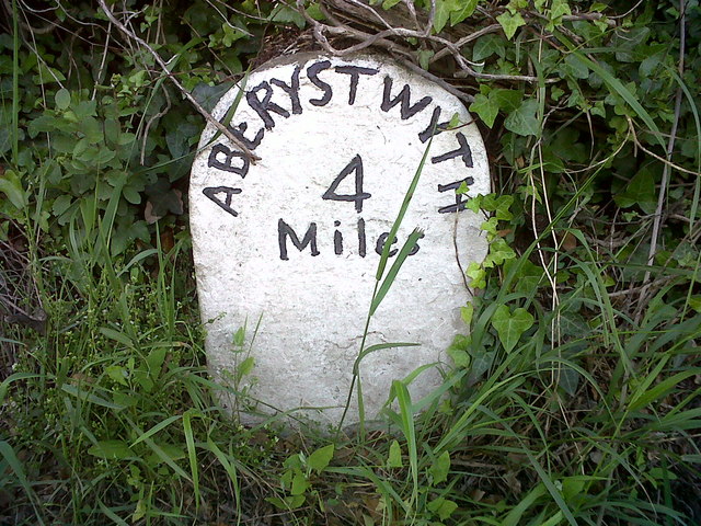
Image: © N Scott Taken: 22 Jun 2015
The milestone used to bear an Ordnance Survey benchmark, which was used on the Warrington to Pembroke Docks line of the First Primary Levelling of England & Wales in 1851-1852. The mark has been erased. Description: 623. Mark on the 4th milestone from Aberystwyth ; 2.46 ft. above surface. Page 533 of the abstract: http://www.trigtools.co.uk/data/1GL/1GLA_533.png
Images are licensed for reuse under creativecommons.org/licenses/by-sa/2.0
Image Location
Latitude
52.364108
Longitude
-4.088798