West Parley: Gallows Drive
Introduction
The photograph on this page of West Parley: Gallows Drive by Chris Downer as part of the Geograph project.
The Geograph project started in 2005 with the aim of publishing, organising and preserving representative images for every square kilometre of Great Britain, Ireland and the Isle of Man.

There are currently over 7.5m images from over 14,400 individuals and you can help contribute to the project by visiting https://www.geograph.org.uk
West Parley: Gallows Drive
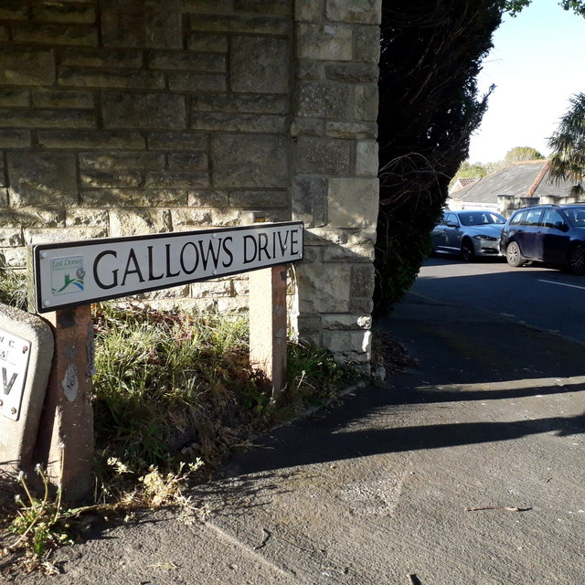
Image: © Chris Downer Taken: 15 Apr 2020
Gallows Drive is at the very corner of the gridsquare and also at the very limit of my 2km radius from home. The sign here is a modern one with the logo of East Dorset District Council, which was absolved in the Local Government Reorganisation of April 2019 when Dorset became a unitary authority and the districts under it were abolished. This is photo no.155 of a series of 453 in my coronavirus lockdown walking project: See https://www.geograph.org.uk/article/My-2020-Coronavirus-Lockdown-walking-project for the complete set of photos.
Images are licensed for reuse under creativecommons.org/licenses/by-sa/2.0
Image Location
Latitude
50.781792
Longitude
-1.888034