The Ure at Sleningford
Introduction
The photograph on this page of The Ure at Sleningford by Gordon Hatton as part of the Geograph project.
The Geograph project started in 2005 with the aim of publishing, organising and preserving representative images for every square kilometre of Great Britain, Ireland and the Isle of Man.

There are currently over 7.5m images from over 14,400 individuals and you can help contribute to the project by visiting https://www.geograph.org.uk
The Ure at Sleningford
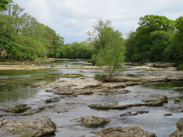
Image: © Gordon Hatton Taken: 13 May 2020
Just upstream from Sleningford Mill where the river winds its way through and over areas of flat limestone. This is not the Carboniferous Limestone of the Dales, but part of the thin strip of Permian [Magnesian] Limestone that runs from Derbyshire to County Durham and which can be seen more locally at Knaresborough where the Nidd runs through a limestone and sandstone gorge.
Images are licensed for reuse under creativecommons.org/licenses/by-sa/2.0
Image Location
Latitude
54.201139
Longitude
-1.57412