Railway Hill
Introduction
The photograph on this page of Railway Hill by John Baker as part of the Geograph project.
The Geograph project started in 2005 with the aim of publishing, organising and preserving representative images for every square kilometre of Great Britain, Ireland and the Isle of Man.

There are currently over 7.5m images from over 14,400 individuals and you can help contribute to the project by visiting https://www.geograph.org.uk
Railway Hill
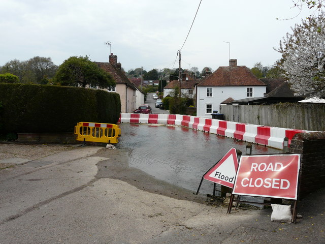
Image: © John Baker Taken: 16 Apr 2020
Barriers have been erected to divert the floodwater of the Nail Bourne into The Causeway and this has meant the closure of Railway Hill. This was Robin Webster’s photo of the Image in February 2020 and this was the same Image in February 2014.
Images are licensed for reuse under creativecommons.org/licenses/by-sa/2.0
Image Location
Latitude
51.201677
Longitude
1.155385