Pasture and Ettingshall Park housing, Wolverhampton
Introduction
The photograph on this page of Pasture and Ettingshall Park housing, Wolverhampton by Roger Kidd as part of the Geograph project.
The Geograph project started in 2005 with the aim of publishing, organising and preserving representative images for every square kilometre of Great Britain, Ireland and the Isle of Man.

There are currently over 7.5m images from over 14,400 individuals and you can help contribute to the project by visiting https://www.geograph.org.uk
Pasture and Ettingshall Park housing, Wolverhampton
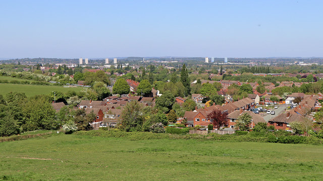
Image: © Roger Kidd Taken: 6 May 2020
This view is from the public track on Beacon Hill, looking north-east across pasture and towards Ettingshall Park housing and Lanesfield, part of Wolverhampton. On the skyline are the four tower blocks in Heath Town, Wolverhampton. To the right of those is the incinerator chimney at New Cross Hospital. To the right of that are the three tower blocks (two painted blue) in Wednesfield. In the far distance is the forestry of Cannock Chase.
Images are licensed for reuse under creativecommons.org/licenses/by-sa/2.0
Image Location
Latitude
52.555298
Longitude
-2.121196