16, Kneeton Vale, Sherwood
Introduction
The photograph on this page of 16, Kneeton Vale, Sherwood by Stephen Mills as part of the Geograph project.
The Geograph project started in 2005 with the aim of publishing, organising and preserving representative images for every square kilometre of Great Britain, Ireland and the Isle of Man.

There are currently over 7.5m images from over 14,400 individuals and you can help contribute to the project by visiting https://www.geograph.org.uk
16, Kneeton Vale, Sherwood
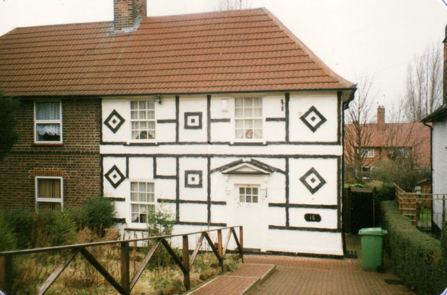
Image: © Stephen Mills Taken: Unknown
My parents' house for a few years; this picture was taken shortly before the purchase. The ridiculous Tudor-style decoration was installed by the previous owner, inadvertently resembling maritime signal flags somewhat. All of this was taken down shortly after the purchase, needless to say!
Images are licensed for reuse under creativecommons.org/licenses/by-sa/2.0
Image Location
Latitude
52.98742
Longitude
-1.150428