Remains of the Buttercross, Scarborough
Introduction
The photograph on this page of Remains of the Buttercross, Scarborough by Maigheach-gheal as part of the Geograph project.
The Geograph project started in 2005 with the aim of publishing, organising and preserving representative images for every square kilometre of Great Britain, Ireland and the Isle of Man.

There are currently over 7.5m images from over 14,400 individuals and you can help contribute to the project by visiting https://www.geograph.org.uk
Remains of the Buttercross, Scarborough
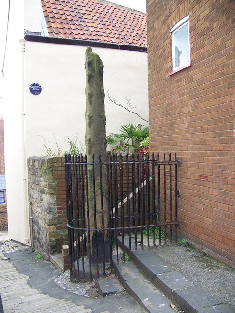
Image: © Maigheach-gheal Taken: 16 Oct 2007
The earliest known reference to the Buttercross in Scarborough is in 1395. Its exact date of origin is not known but it is believed to have formed part of the entrance to the old Borough in the 1200s. Doubts have been cast on its original position but it is clearly shown in the New and Exact Plan of Scarborough in 1725 in more or less its present position. In the days clearly it was a proper cross, but there is no record of the disappearance or dismantling of the stone cross-member.
Images are licensed for reuse under creativecommons.org/licenses/by-sa/2.0
Image Location


Leaflet Map data © OpenStreetMap
Latitude
54.28506
Longitude
-0.396436