Old Boundary Marker
Introduction
The photograph on this page of Old Boundary Marker by R Templeman as part of the Geograph project.
The Geograph project started in 2005 with the aim of publishing, organising and preserving representative images for every square kilometre of Great Britain, Ireland and the Isle of Man.

There are currently over 7.5m images from over 14,400 individuals and you can help contribute to the project by visiting https://www.geograph.org.uk
Old Boundary Marker
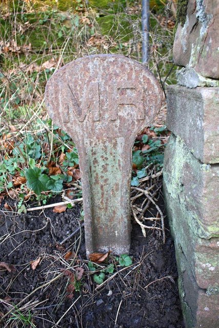
Image: © R Templeman Taken: 19 Feb 2019
Railway Boundary Marker on the northeast side of the B6542 Battlebarrow at the end of a low stone wall. APPLEBY IN WESTMORLAND parish. M R (Midland Railway) in raised lettering. Milestone Society National ID: WE_APPL02em
Images are licensed for reuse under creativecommons.org/licenses/by-sa/2.0
Image Location
Latitude
54.583644
Longitude
-2.49323