Old Boundary Marker
Introduction
The photograph on this page of Old Boundary Marker by R Grant as part of the Geograph project.
The Geograph project started in 2005 with the aim of publishing, organising and preserving representative images for every square kilometre of Great Britain, Ireland and the Isle of Man.

There are currently over 7.5m images from over 14,400 individuals and you can help contribute to the project by visiting https://www.geograph.org.uk
Old Boundary Marker
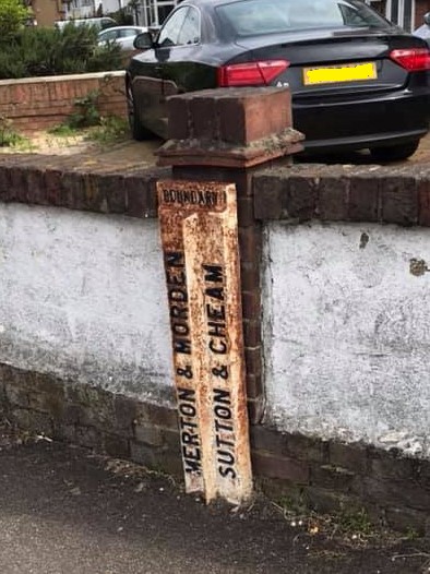
Image: © R Grant Taken: 7 May 2019
Parish Boundary Marker against a front garden wall at the junction of the A24 Epsom Road with Elm Road, Morden. On the boundary of Merton and Sutton. In raised lettering MERTON & MORDEN and SUTTON & CHEAM vertically side by side with BOUNDARY horizontally above both. See also https://www.geograph.org.uk/photo/3320140. Milestone Society National ID: SY_MORD02pb
Images are licensed for reuse under creativecommons.org/licenses/by-sa/2.0
Image Location
Latitude
51.387882
Longitude
-0.208551