Old Boundary Marker
Introduction
The photograph on this page of Old Boundary Marker by P Hamilton as part of the Geograph project.
The Geograph project started in 2005 with the aim of publishing, organising and preserving representative images for every square kilometre of Great Britain, Ireland and the Isle of Man.

There are currently over 7.5m images from over 14,400 individuals and you can help contribute to the project by visiting https://www.geograph.org.uk
Old Boundary Marker
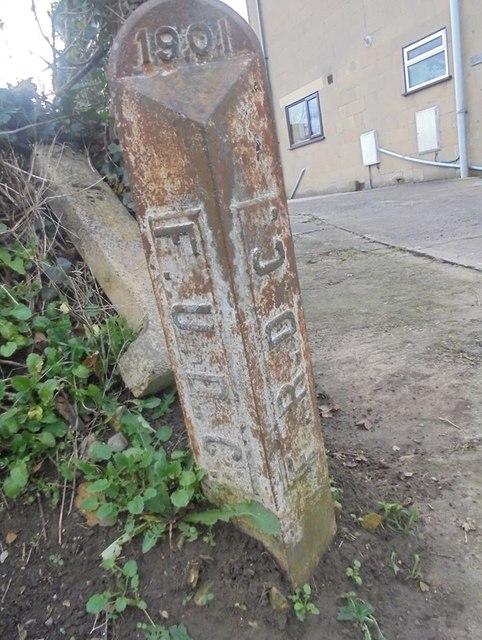
Image: © P Hamilton Taken: 30 Nov 2019
Municipal Boundary Marker at the side of the drive to a house on the south side of Egford Lane. FROME parish. In raised lettering F.R.D.C. on the left face and F.U.D.C. on the right face, both vertically, with 1901 horizontally on the head face, marking the former boundary of Frome Urban and Frome Rural Districts. Milestone Society National ID: SO_FUDFRD03pb
Images are licensed for reuse under creativecommons.org/licenses/by-sa/2.0
Image Location
Latitude
51.233391
Longitude
-2.3396