
Old Boundary Marker
Introduction
The photograph on this page of Old Boundary Marker by Mike Rayner as part of the Geograph project.
The Geograph project started in 2005 with the aim of publishing, organising and preserving representative images for every square kilometre of Great Britain, Ireland and the Isle of Man.

There are currently over 7.5m images from over 14,400 individuals and you can help contribute to the project by visiting https://www.geograph.org.uk
Old Boundary Marker
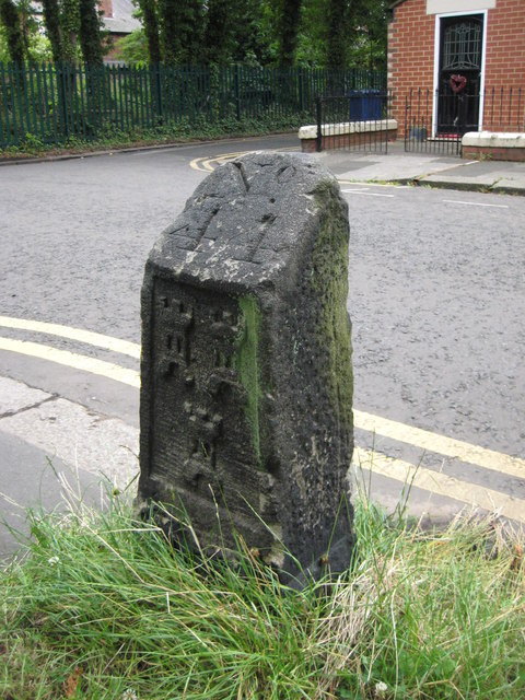
Image: © Mike Rayner Taken: 22 Jul 2019
Estate Boundary Marker on the north side and opposite no 73 Highbury, Newcastle upon Tyne. The arms of Newcastle are displayed in relief on its face and No 44 is incised on its top. Probably erected after the legal dispute in 1770 between the freemen and the mayor and burgesses concerning ownership of the Town Moor. Grade II Listed https://historicengland.org.uk/listing/the-list/list-entry/1145896. Milestone Society National ID: NB_NEWC05em
Images are licensed for reuse under creativecommons.org/licenses/by-sa/2.0
Image Location

Latitude
54.997301
Longitude
-1.61194