Beltinge Village Osborne Gardens Field
Introduction
The photograph on this page of Beltinge Village Osborne Gardens Field by Matt Allsop as part of the Geograph project.
The Geograph project started in 2005 with the aim of publishing, organising and preserving representative images for every square kilometre of Great Britain, Ireland and the Isle of Man.

There are currently over 7.5m images from over 14,400 individuals and you can help contribute to the project by visiting https://www.geograph.org.uk
Beltinge Village Osborne Gardens Field
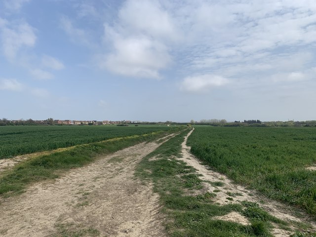
Image: © Matt Allsop Taken: 17 Apr 2020
This shot was taken in the field off the back of Osborne Gardens in the Village of Beltinge. To the right of this image down a track is the railway line and on the distance to the left is the Hillborough housing estate. This view will soon be impossible as developers are building another 1,300 home estate on this field. Villagers are campaigning to build a bypass bridge near the Thanet Way to divert the mass traffic from this development away from the town.
Images are licensed for reuse under creativecommons.org/licenses/by-sa/2.0
Image Location
Latitude
51.365769
Longitude
1.164361