Stanford Brook passes under the Brighton Line
Introduction
The photograph on this page of Stanford Brook passes under the Brighton Line by Robin Webster as part of the Geograph project.
The Geograph project started in 2005 with the aim of publishing, organising and preserving representative images for every square kilometre of Great Britain, Ireland and the Isle of Man.

There are currently over 7.5m images from over 14,400 individuals and you can help contribute to the project by visiting https://www.geograph.org.uk
Stanford Brook passes under the Brighton Line
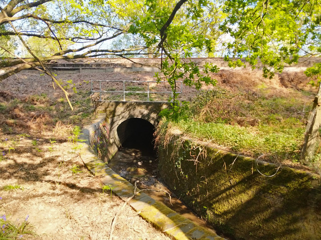
Image: © Robin Webster Taken: 26 Apr 2020
Upstream from here, the brook was diverted to a straight channel alongside the railway when the Brighton Line was built in the late 1830s. Here it is conducted around a right-angled bend to pass under the railway.
Images are licensed for reuse under creativecommons.org/licenses/by-sa/2.0
Image Location
Latitude
51.096779
Longitude
-0.161269