WD No5
Introduction
The photograph on this page of WD No5 by Kenneth Allen as part of the Geograph project.
The Geograph project started in 2005 with the aim of publishing, organising and preserving representative images for every square kilometre of Great Britain, Ireland and the Isle of Man.

There are currently over 7.5m images from over 14,400 individuals and you can help contribute to the project by visiting https://www.geograph.org.uk
WD No5
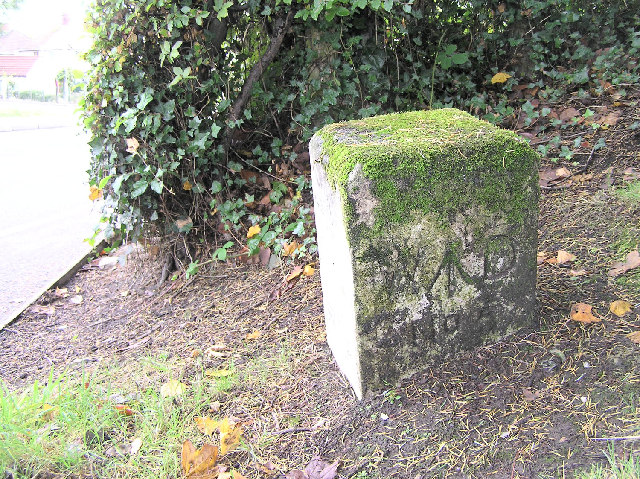
Image: © Kenneth Allen Taken: 11 Oct 2005
This War Department Marker Stone is at the grass verge along the Hospital Road, Omagh - no one ever disturbs or vandalises it. It is the only one that I currently know of that is in this area In October 2017 I noted that a newly planted laurel hedge was starting to hide it Image I noticed another marker stone near Buncrana County Donegal Image It was near an ancient fort, one of several Napoleonic batteries designed to counter the threat of French invasion Image Recently as a result of site works another stone about 50 metres away was unearthed and though I couldn't see any markings, I thought it could be another one Image In October 2018, I noted that WD no.5 was hidden from view behind a hedge Image
Images are licensed for reuse under creativecommons.org/licenses/by-sa/2.0
Image Location


Leaflet Map data © OpenStreetMap
Latitude
54.598616
Longitude
-7.28285