The Crown, redeveloped
Introduction
The photograph on this page of The Crown, redeveloped by Richard Law as part of the Geograph project.
The Geograph project started in 2005 with the aim of publishing, organising and preserving representative images for every square kilometre of Great Britain, Ireland and the Isle of Man.

There are currently over 7.5m images from over 14,400 individuals and you can help contribute to the project by visiting https://www.geograph.org.uk
The Crown, redeveloped
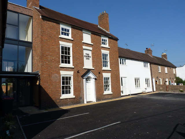
Image: © Richard Law Taken: 24 Apr 2020
Almost exactly 3 years on from Image and the work's now completed; The Crown has been converted to a house, and the adjoining cottages Image have likewise been finished. All currently for sale, and all still Grade II listed https://britishlistedbuildings.co.uk/101038646-crown-inn-including-outbuildings-adjoining-south-west-the-gorge#.XqRmsmhKjIV https://historicengland.org.uk/listing/the-list/list-entry/1038646 https://britishlistedbuildings.co.uk/101038647-11-14-hodgebower-the-gorge and https://historicengland.org.uk/listing/the-list/list-entry/1038647
Images are licensed for reuse under creativecommons.org/licenses/by-sa/2.0
Image Location
Latitude
52.629611
Longitude
-2.484998