Morar House
Introduction
The photograph on this page of Morar House by Lairich Rig as part of the Geograph project.
The Geograph project started in 2005 with the aim of publishing, organising and preserving representative images for every square kilometre of Great Britain, Ireland and the Isle of Man.

There are currently over 7.5m images from over 14,400 individuals and you can help contribute to the project by visiting https://www.geograph.org.uk
Morar House
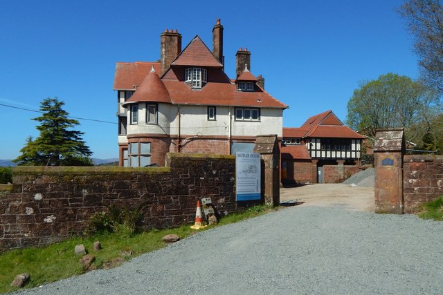
Image: © Lairich Rig Taken: 3 May 2017
It is now called Drumadoon, and it is seen here from Image, where it is set opposite Image The house is the work of William Leiper, who designed it for the McAlpines, proprietors of a Glasgow shipping firm; see its listing text — http://portal.historicenvironment.scot/designation/LB34763 — for further information.
Images are licensed for reuse under creativecommons.org/licenses/by-sa/2.0
Image Location
Latitude
56.017308
Longitude
-4.729672