The Grey Horse Pub, Shiremoor
Introduction
The photograph on this page of The Grey Horse Pub, Shiremoor by Geoff Holland as part of the Geograph project.
The Geograph project started in 2005 with the aim of publishing, organising and preserving representative images for every square kilometre of Great Britain, Ireland and the Isle of Man.

There are currently over 7.5m images from over 14,400 individuals and you can help contribute to the project by visiting https://www.geograph.org.uk
The Grey Horse Pub, Shiremoor
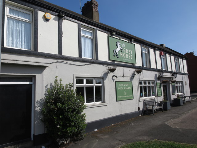
Image: © Geoff Holland Taken: 22 Apr 2020
This pub stands at the old cross roads which lead, in one direction to Newcastle, in another direction to Blyth, and in the third direction to North Shields. The old cross roads are marked with an old signpost which is a well-preserved reminder of what road signs were like before they were redesigned by Margaret Calvert in the 1960s. When the first Ordnance Survey Six-Inch map of the area was published in 1865, the pub, then referred to as 'The Grey Horse Inn', along with adjoining Bertram Place were the only buildings standing at this point. For a selection of detailed free to download walking routes in the area visit www.northtynesidewalks.co.uk
Images are licensed for reuse under creativecommons.org/licenses/by-sa/2.0
Image Location
Latitude
55.039794
Longitude
-1.504561