Ensbury Park: Boundary Road
Introduction
The photograph on this page of Ensbury Park: Boundary Road by Chris Downer as part of the Geograph project.
The Geograph project started in 2005 with the aim of publishing, organising and preserving representative images for every square kilometre of Great Britain, Ireland and the Isle of Man.

There are currently over 7.5m images from over 14,400 individuals and you can help contribute to the project by visiting https://www.geograph.org.uk
Ensbury Park: Boundary Road
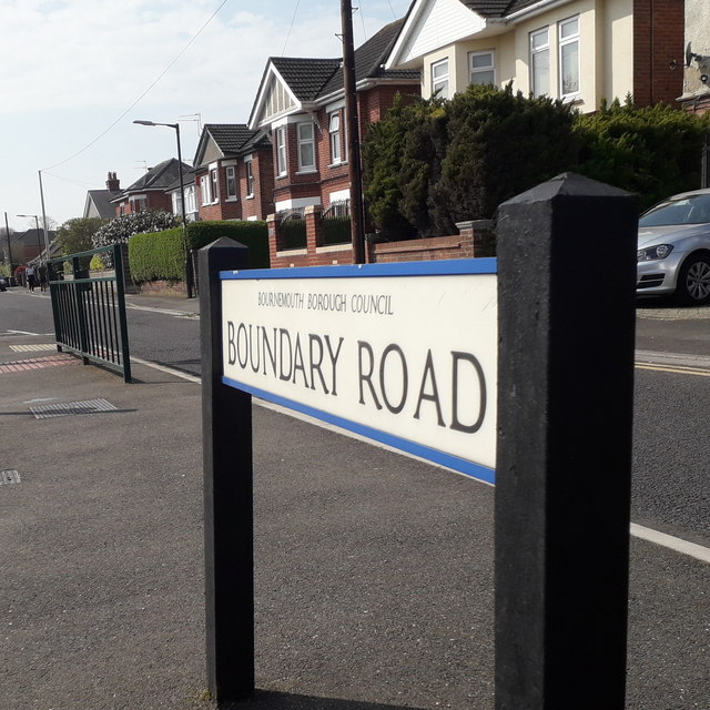
Image: © Chris Downer Taken: 10 Apr 2020
Boundary Road was, as its name suggests, a boundary and it was quite a major one: it was the boundary between Hampshire and Dorset until 1931, when the area to the west of here was transferred to Bournemouth and thus to Hampshire. (The whole of Bournemouth would then transfer from Hampshire to Dorset 70 years later.) While it has diminished in the importance of the boundary, it has gained importance as a route. Until quite recently it was a gravel road, when the A347 went along Wimborne Road through Moordown and Winton. But in the mid-1980s the A347 was rerouted to Redhill Avenue, through Redhill Common, and along here, so it is now a busy main road carrying much suburban and regional traffic to and from Bournemouth town. We view it here at the traffic-light junction with Victoria Avenue; the houses have their own parallel service road which comes past the junction. The sign, announcing the street name to traffic arriving from Victoria Avenue, is a modern one, erected around 2017, by which time the council had replaced the coloured logo, which had been prone to fading after a while, to simple wording BOURNEMOUTH BOROUGH COUNCIL in smaller type. This is photo no.44 of a series of 453 in my coronavirus lockdown walking project: See https://www.geograph.org.uk/article/My-2020-Coronavirus-Lockdown-walking-project for the complete set of photos.
Images are licensed for reuse under creativecommons.org/licenses/by-sa/2.0
Image Location
Latitude
50.750047
Longitude
-1.886833