Dawson's Heights
Introduction
The photograph on this page of Dawson's Heights by Brian Whittle as part of the Geograph project.
The Geograph project started in 2005 with the aim of publishing, organising and preserving representative images for every square kilometre of Great Britain, Ireland and the Isle of Man.

There are currently over 7.5m images from over 14,400 individuals and you can help contribute to the project by visiting https://www.geograph.org.uk
Dawson's Heights
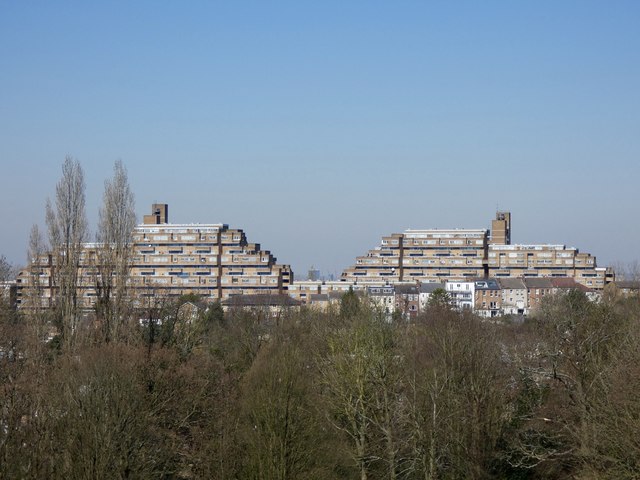
Image: © Brian Whittle Taken: 25 Mar 2020
Like a pair of car ferries stranded on top of the hill, these flats are a landmark for the area. Designed by Kate Macintosh, they were built between 1964 and 1972 and have become sought after for their views across London and the local area.
Images are licensed for reuse under creativecommons.org/licenses/by-sa/2.0
Image Location
Latitude
51.447155
Longitude
-0.067213