Old Boundary Marker
Introduction
The photograph on this page of Old Boundary Marker by D Garside as part of the Geograph project.
The Geograph project started in 2005 with the aim of publishing, organising and preserving representative images for every square kilometre of Great Britain, Ireland and the Isle of Man.

There are currently over 7.5m images from over 14,400 individuals and you can help contribute to the project by visiting https://www.geograph.org.uk
Old Boundary Marker
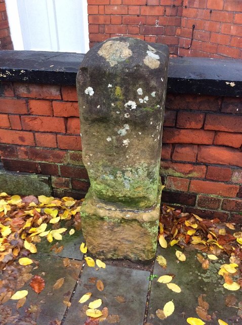
Image: © D Garside Taken: 24 Nov 2019
Municipal Boundary Marker on the east side of the road against the front garden wall of a house 15m north of the Newport Arch, Lincoln, showing a coat of arms. Grade II Listed https://historicengland.org.uk/listing/the-list/list-entry/1388725. Milestone Society National ID: LI_LIN04pb
Images are licensed for reuse under creativecommons.org/licenses/by-sa/2.0
Image Location
Latitude
53.237362
Longitude
-0.537995