Humber Avenue, Jaywick
Introduction
The photograph on this page of Humber Avenue, Jaywick by Stephen McKay as part of the Geograph project.
The Geograph project started in 2005 with the aim of publishing, organising and preserving representative images for every square kilometre of Great Britain, Ireland and the Isle of Man.

There are currently over 7.5m images from over 14,400 individuals and you can help contribute to the project by visiting https://www.geograph.org.uk
Humber Avenue, Jaywick
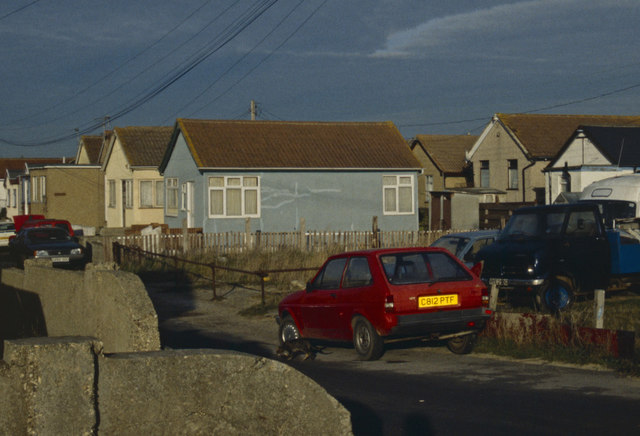
Image: © Stephen McKay Taken: Unknown
Jaywick has earned an unenviable reputation in recent years after being named the most economically deprived area in the country. Yet it is no inner city slum, but rather a seaside resort consisting mainly of detached dwellings close to a sandy beach. The land was originally purchased in the 1920s by an entrepreneur called Frank Stedman who sold it off as small plots for Londoners to build holiday homes. The houses they built were generally rather flimsy and were never intended to be permanent dwellings and it is unlikely anybody envisaged that they would last as long as they have. However, after the Second World War a shortage of housing led to many of the properties becoming occupied on a permanent basis. Unlike many similar developments, Jaywick's sub-standard houses were never demolished and became home to many unemployed and elderly residents. This 1998 scene shows a street in the Brooklands area of the town.
Images are licensed for reuse under creativecommons.org/licenses/by-sa/2.0
Image Location
Latitude
51.772711
Longitude
1.102443