London Road
Introduction
The photograph on this page of London Road by Simon Carey as part of the Geograph project.
The Geograph project started in 2005 with the aim of publishing, organising and preserving representative images for every square kilometre of Great Britain, Ireland and the Isle of Man.

There are currently over 7.5m images from over 14,400 individuals and you can help contribute to the project by visiting https://www.geograph.org.uk
London Road
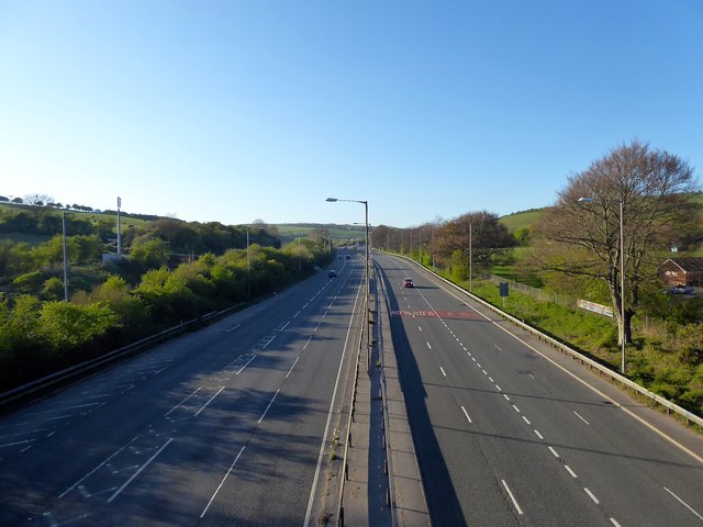
Image: © Simon Carey Taken: 15 Apr 2020
An empty A23 during the Cover-19 lockdown. The slope of Sweet Hill is on the left and Braypool Sports Ground to the right.
Images are licensed for reuse under creativecommons.org/licenses/by-sa/2.0
Image Location
Latitude
50.87239
Longitude
-0.160733