Old Boundary Marker
Introduction
The photograph on this page of Old Boundary Marker by W MacDonald as part of the Geograph project.
The Geograph project started in 2005 with the aim of publishing, organising and preserving representative images for every square kilometre of Great Britain, Ireland and the Isle of Man.

There are currently over 7.5m images from over 14,400 individuals and you can help contribute to the project by visiting https://www.geograph.org.uk
Old Boundary Marker
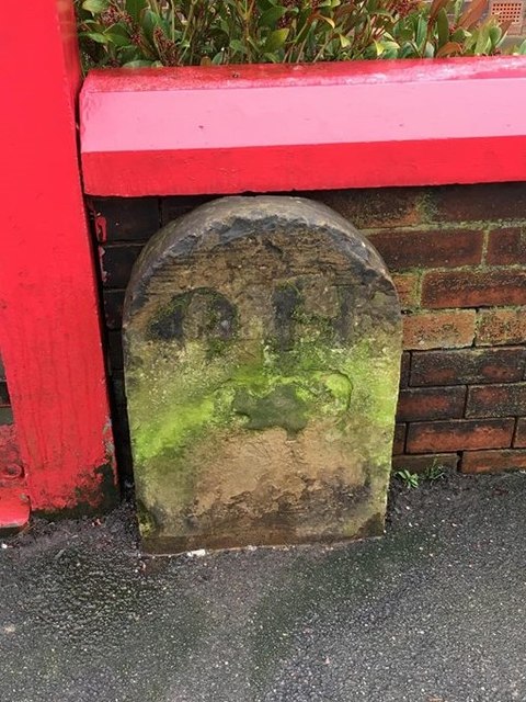
Image: © W MacDonald Taken: 26 Jan 2019
Parish Boundary Marker on the south side of A579 St Helens Road beside the front gate of no.499. On the former boundary of Over Hulton and Middle Hulton parishes but now entirely in BOLTON. Inscribed O H on its centre face. Milestone Society National ID: LA_OHUMHU01pb
Images are licensed for reuse under creativecommons.org/licenses/by-sa/2.0
Image Location
Latitude
53.557405
Longitude
-2.462112