Path under Lomond Road
Introduction
The photograph on this page of Path under Lomond Road by Lairich Rig as part of the Geograph project.
The Geograph project started in 2005 with the aim of publishing, organising and preserving representative images for every square kilometre of Great Britain, Ireland and the Isle of Man.

There are currently over 7.5m images from over 14,400 individuals and you can help contribute to the project by visiting https://www.geograph.org.uk
Path under Lomond Road
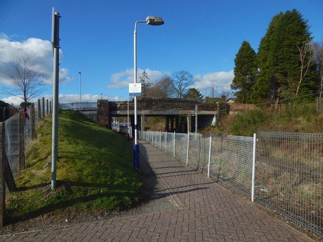
Image: © Lairich Rig Taken: 20 Mar 2020
It goes from Burns Street in Levenvale (at this end) to Balloch Station; a train can be seen at the station platform. (Burns Street in Levenvale is named after Robert Burns, while Burn Street in nearby Bonhill is so called because a burn used to flow along it: Image) The small bridge shown here takes Lomond Road over the railway line. Out of shot to the right, that road crosses the River Leven by means of a much more substantial bridge, as shown on the map, but at this time the road was closed there because of work on the bridge: Image / Image / Image Burns Street itself is shown in Image For the railway station, see, for example, Image (in which the same bridge is seen from the other side), Image, and Image
Images are licensed for reuse under creativecommons.org/licenses/by-sa/2.0
Image Location
Latitude
56.00124
Longitude
-4.582731