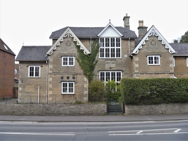
Devizes buildings [70]
Introduction
The photograph on this page of Devizes buildings [70] by Michael Dibb as part of the Geograph project.
The Geograph project started in 2005 with the aim of publishing, organising and preserving representative images for every square kilometre of Great Britain, Ireland and the Isle of Man.
There are currently over 7.5m images from over 14,400 individuals and you can help contribute to the project by visiting https://www.geograph.org.uk

Image: © Michael Dibb Taken: 13 Mar 2020
Built as a school in 1861, the building has recently been used as a youth centre and as accommodation for the local Girl Guides and Brownies. A number of recent planning applications have been made to convert the building into one residential house or into several apartments. Listed, grade II, with details at: https://historicengland.org.uk/listing/the-list/list-entry/1249476 The market town of Devizes developed around its 11th century castle. It gained a charter in 1141 and holds a weekly market in the large and picturesque Market Place. In the 16th century the town became known for its textiles and in the early 18th century held the largest corn market in the West Country. Devizes has about 500 listed buildings - a very large number for a small town.

