Footbridge over unnamed stream, Whitley Bay
Introduction
The photograph on this page of Footbridge over unnamed stream, Whitley Bay by Geoff Holland as part of the Geograph project.
The Geograph project started in 2005 with the aim of publishing, organising and preserving representative images for every square kilometre of Great Britain, Ireland and the Isle of Man.

There are currently over 7.5m images from over 14,400 individuals and you can help contribute to the project by visiting https://www.geograph.org.uk
Footbridge over unnamed stream, Whitley Bay
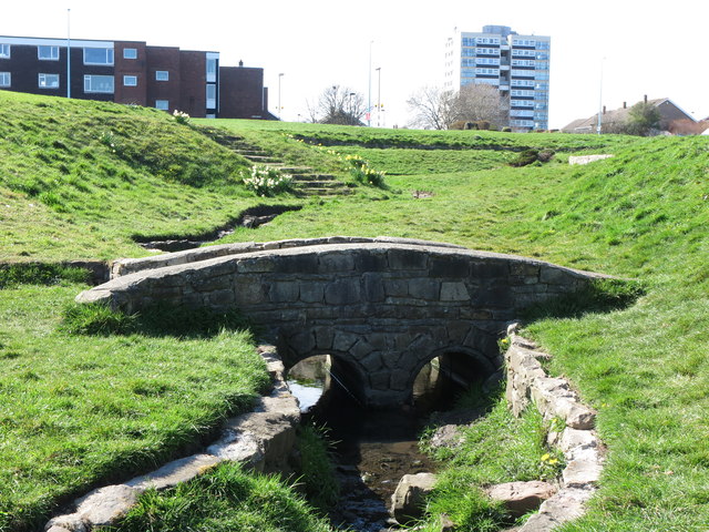
Image: © Geoff Holland Taken: 11 Apr 2020
This slightly formalised/ornamental dene, with an unnamed stream flowing through it, is extremely short in length, stretching from the Whitley Bay to St. Mary's Island road (A193) to the northern promenade and Whitley Bay beach. Originally, it would seem that this watercourse drained the farmland belonging to Whitley Lodge Farm lying immediately to the west and on which Whitley Lodge Estate is now built. The multi storey building in the background is called Beacon House. For a selection of detailed free to download walking routes in the area visit www.northtynesidewalks.co.uk
Images are licensed for reuse under creativecommons.org/licenses/by-sa/2.0
Image Location
Latitude
55.056109
Longitude
-1.45317