Old Boundary Marker
Introduction
The photograph on this page of Old Boundary Marker by D Dickson as part of the Geograph project.
The Geograph project started in 2005 with the aim of publishing, organising and preserving representative images for every square kilometre of Great Britain, Ireland and the Isle of Man.

There are currently over 7.5m images from over 14,400 individuals and you can help contribute to the project by visiting https://www.geograph.org.uk
Old Boundary Marker
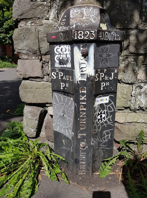
Image: © D Dickson Taken: 2 Sep 2019
Turnpike Parish Boundary Marker against a stone wall beside a walkway at the end of Summers Road. On the boundary of St Paul and St Philip and St Jacob wards, Bristol. ST PAUL / PH on the left face, ST PP & JB / PH on the right face, BRISTOL TURNPIKE TRUST vertically on the front between the two with 1823 above that. Milestone Society National ID: GL_BRIS07pb
Images are licensed for reuse under creativecommons.org/licenses/by-sa/2.0
Image Location
Latitude
51.466334
Longitude
-2.575891