Carlton Place
Introduction
The photograph on this page of Carlton Place by Thomas Nugent as part of the Geograph project.
The Geograph project started in 2005 with the aim of publishing, organising and preserving representative images for every square kilometre of Great Britain, Ireland and the Isle of Man.

There are currently over 7.5m images from over 14,400 individuals and you can help contribute to the project by visiting https://www.geograph.org.uk
Carlton Place
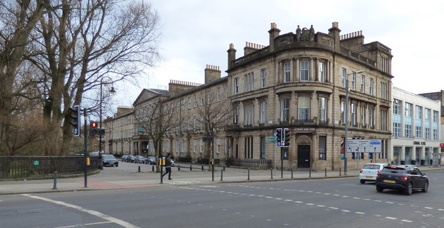
Image: © Thomas Nugent Taken: 6 Mar 2020
Bridge Street is on the right, Carlton Place on the left. The building on the corner is Category A Listed http://portal.historicenvironment.scot/designation/LB33492 and was formerly a Bank of Scotland.
Images are licensed for reuse under creativecommons.org/licenses/by-sa/2.0
Image Location
Latitude
55.854561
Longitude
-4.258045