Old Boundary Marker on Lethlean Lane, Hayle
Introduction
The photograph on this page of Old Boundary Marker on Lethlean Lane, Hayle by R Hanns as part of the Geograph project.
The Geograph project started in 2005 with the aim of publishing, organising and preserving representative images for every square kilometre of Great Britain, Ireland and the Isle of Man.

There are currently over 7.5m images from over 14,400 individuals and you can help contribute to the project by visiting https://www.geograph.org.uk
Old Boundary Marker on Lethlean Lane, Hayle
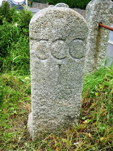
Image: © R Hanns Taken: 29 Aug 2019
Estate Boundary Marker outside the railing at the southwest end of a bridge on Lethlean Lane. HAYLE parish. Inscribed H / 1 and C C C / 1 on opposite faces. One of a series of stones put up by Harvey’s in 1867/8 marking out their waterfront holding acquired from the defunct Cornish Copper Company. Grade II Listed https://historicengland.org.uk/listing/the-list/list-entry/1160132. See also http://www.flickr.com/photos/bridgemarkertim/8488905085. Milestone Society National ID: CW_HAY05em
Images are licensed for reuse under creativecommons.org/licenses/by-sa/2.0
Image Location
Latitude
50.194722
Longitude
-5.407514