Parish church [1]
Introduction
The photograph on this page of Parish church [1] by Michael Dibb as part of the Geograph project.
The Geograph project started in 2005 with the aim of publishing, organising and preserving representative images for every square kilometre of Great Britain, Ireland and the Isle of Man.

There are currently over 7.5m images from over 14,400 individuals and you can help contribute to the project by visiting https://www.geograph.org.uk
Parish church [1]
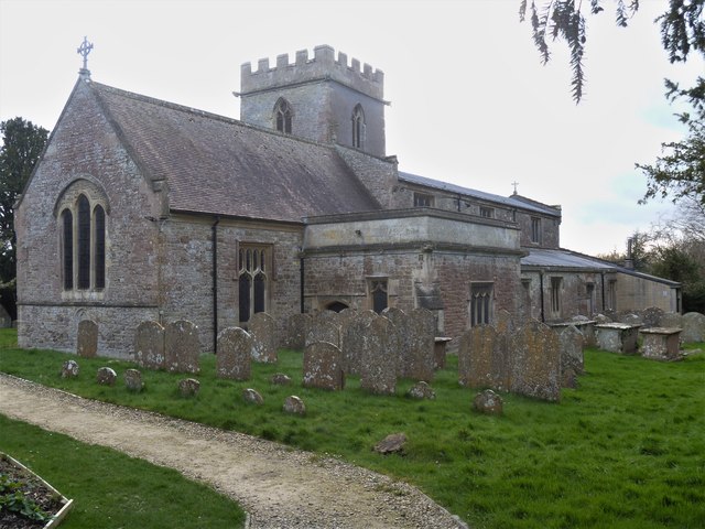
Image: © Michael Dibb Taken: 11 Mar 2020
The church of the Holy Cross has fragments from the 12th century and has a 13th century chancel. The rest of the church is 15th or 16th century mostly in the Perpendicular style. The church contains many wall memorials. Listed, grade I, with details at: https://historicengland.org.uk/listing/the-list/list-entry/1023312 Chiseldon village was founded by the Saxons and lies 3 miles south of Swindon on the Roman road from Cirencester and Mildenhall, now the A346. An agricultural village until the late 19th century but now most workers commute to Swindon. In 1914 a large military camp was built south of the village with the camp population being greater than that of the village. The military presence continued until 1961.
Images are licensed for reuse under creativecommons.org/licenses/by-sa/2.0
Image Location
Latitude
51.518254
Longitude
-1.731746