Closed building site, Hessle
Introduction
The photograph on this page of Closed building site, Hessle by Paul Harrop as part of the Geograph project.
The Geograph project started in 2005 with the aim of publishing, organising and preserving representative images for every square kilometre of Great Britain, Ireland and the Isle of Man.

There are currently over 7.5m images from over 14,400 individuals and you can help contribute to the project by visiting https://www.geograph.org.uk
Closed building site, Hessle
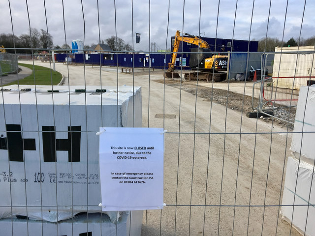
Image: © Paul Harrop Taken: 28 Mar 2020
Western section of the extensive housing developments to the south of Jenny Brough Lane at Tranby Fields. The access road is blocked here, with a notice saying that the site is closed until further notice, due to the COVID-19 outbreak.
Images are licensed for reuse under creativecommons.org/licenses/by-sa/2.0
Image Location
Latitude
53.730333
Longitude
-0.462493