Lifebelt, Southern End of Newbiggin Bay
Introduction
The photograph on this page of Lifebelt, Southern End of Newbiggin Bay by Geoff Holland as part of the Geograph project.
The Geograph project started in 2005 with the aim of publishing, organising and preserving representative images for every square kilometre of Great Britain, Ireland and the Isle of Man.

There are currently over 7.5m images from over 14,400 individuals and you can help contribute to the project by visiting https://www.geograph.org.uk
Lifebelt, Southern End of Newbiggin Bay
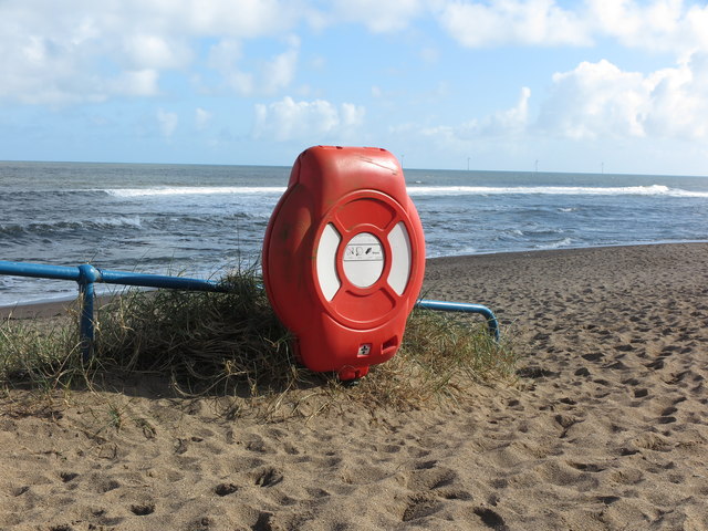
Image: © Geoff Holland Taken: 20 Mar 2020
This lifebelt is attached to the railings at the extreme southern end of the promenade which runs around Newbiggin Bay. Behind, the sea breaks over Spital Carrs and on the distant horizon can be seen four of the five wind turbines making up the Blyth Offshore Demonstrator Wind Farm, which lies four miles off the coast. The 2017-completed wind farm is owned by EDF Energies Nouvelles.
Images are licensed for reuse under creativecommons.org/licenses/by-sa/2.0
Image Location
Latitude
55.178134
Longitude
-1.515566