Thorpe-le-Soken: The Abbey
Introduction
The photograph on this page of Thorpe-le-Soken: The Abbey by Nigel Cox as part of the Geograph project.
The Geograph project started in 2005 with the aim of publishing, organising and preserving representative images for every square kilometre of Great Britain, Ireland and the Isle of Man.

There are currently over 7.5m images from over 14,400 individuals and you can help contribute to the project by visiting https://www.geograph.org.uk
Thorpe-le-Soken: The Abbey
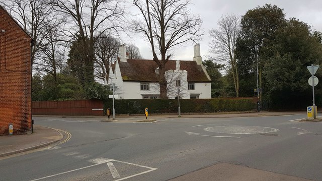
Image: © Nigel Cox Taken: 15 Mar 2020
Occupying a prominent location at the junction of the B1033 High Street with the B1414 Landermere Road, The Abbey is a Grade II* Listed Building, the earliest parts of which date from the mid 16th Century. The Historic England website states that the house was first recorded in 1567 as Borowes, then as Gadlers in 1612, Brickhouse in 1690, Cage Farm in 1779, and finally The Abbey in 1795. There is however no mention on that website of any monastic or ecclesiastical connection.
Images are licensed for reuse under creativecommons.org/licenses/by-sa/2.0
Image Location
Latitude
51.856483
Longitude
1.165144