Vale Lodge
Introduction
The photograph on this page of Vale Lodge by Ian Capper as part of the Geograph project.
The Geograph project started in 2005 with the aim of publishing, organising and preserving representative images for every square kilometre of Great Britain, Ireland and the Isle of Man.

There are currently over 7.5m images from over 14,400 individuals and you can help contribute to the project by visiting https://www.geograph.org.uk
Vale Lodge
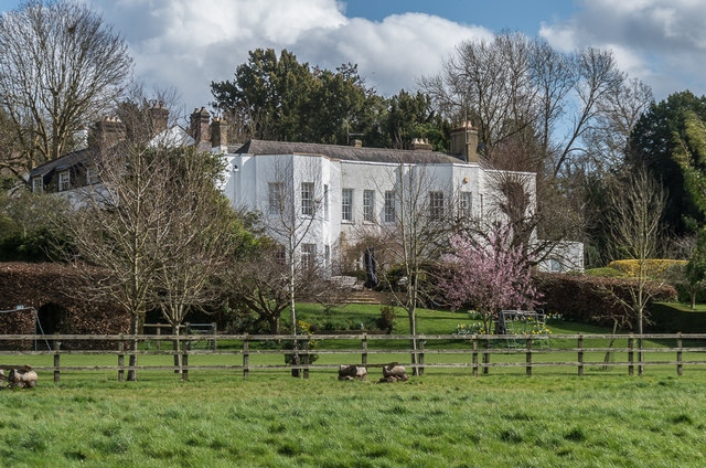
Image: © Ian Capper Taken: 12 Mar 2020
House on Downs Lane, but more visible from Dorking Road, as seen here. Built around 1780 on the site of the former rectory. Now subdivided into 4 apartments. Grade II listed - see www.historicengland.org.uk/listing/the-list/list-entry/1378203.
Images are licensed for reuse under creativecommons.org/licenses/by-sa/2.0
Image Location
Latitude
51.287493
Longitude
-0.326213