Southminster Station goods yard
Introduction
The photograph on this page of Southminster Station goods yard by Brian Whittle as part of the Geograph project.
The Geograph project started in 2005 with the aim of publishing, organising and preserving representative images for every square kilometre of Great Britain, Ireland and the Isle of Man.

There are currently over 7.5m images from over 14,400 individuals and you can help contribute to the project by visiting https://www.geograph.org.uk
Southminster Station goods yard
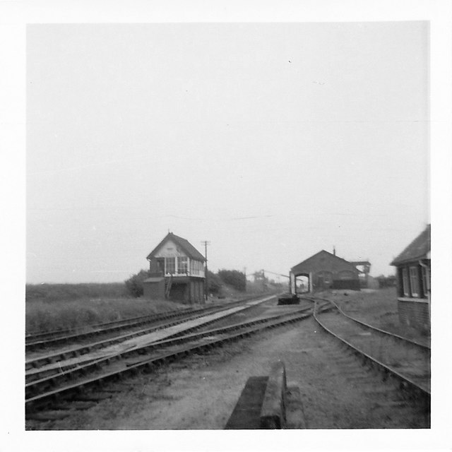
Image: © Brian Whittle Taken: 30 Sep 1970
July 1970 (exact day unknown). View south to the goods yard, in the distance is the gravel loading structures which were in use until 1979 (according to Wikipedia), to the right the goods shed and just to the right and behind of that, the nuclear flask facility. This was used last in August 2006 (again, info courtesy of Wikipedia)
Images are licensed for reuse under creativecommons.org/licenses/by-sa/2.0
Image Location
Latitude
51.658434
Longitude
0.834188