Westleigh House site - now extension of car park
Introduction
The photograph on this page of Westleigh House site - now extension of car park by Duncan Graham as part of the Geograph project.
The Geograph project started in 2005 with the aim of publishing, organising and preserving representative images for every square kilometre of Great Britain, Ireland and the Isle of Man.

There are currently over 7.5m images from over 14,400 individuals and you can help contribute to the project by visiting https://www.geograph.org.uk
Westleigh House site - now extension of car park
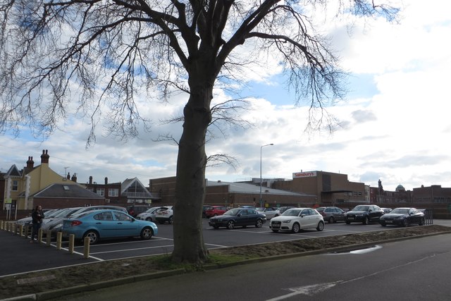
Image: © Duncan Graham Taken: 6 Mar 2020
The photo shows the site of Westleigh House, which formerly housed Tendring District Council offices. It was demolished in 2019, making way for extra spaces for the neighbouring car park. Image] is from the same viewpoint in July 2014, only the tree, the white arrow on tarmac at bottom of picture and chimney pots of buildings in the High Street to the left being unchanged. The picture was taken in Carnarvon Road. Beyond the car park, in the centre of the image, is the rear of the Sainsbury's store in the High Street. To the right, on the horizon, is the green dome of what was once a branch of Barclays Bank and is now a Sense shop, on the corner of the High Street and Station Road.
Images are licensed for reuse under creativecommons.org/licenses/by-sa/2.0
Image Location
Latitude
51.791542
Longitude
1.155225