Ackleton Hall, Ackleton
Introduction
The photograph on this page of Ackleton Hall, Ackleton by Richard Law as part of the Geograph project.
The Geograph project started in 2005 with the aim of publishing, organising and preserving representative images for every square kilometre of Great Britain, Ireland and the Isle of Man.

There are currently over 7.5m images from over 14,400 individuals and you can help contribute to the project by visiting https://www.geograph.org.uk
Ackleton Hall, Ackleton
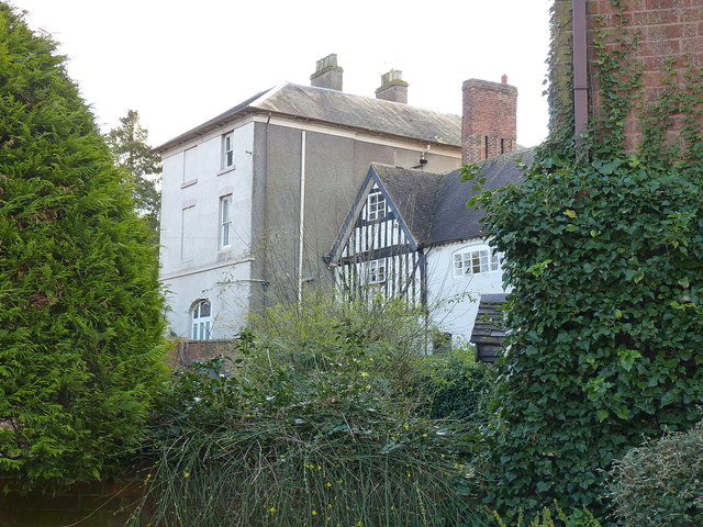
Image: © Richard Law Taken: 1 Mar 2020
The larger part of the hall, built of roughcast rendered brick, and which dates from the early 19th century, rather hides away behind surrounding buildings. It was Grade II listed https://britishlistedbuildings.co.uk/101053722-ackleton-hall-worfield#.XmFP4Kj7TIU & https://historicengland.org.uk/listing/the-list/list-entry/1053722 in 1974.
Images are licensed for reuse under creativecommons.org/licenses/by-sa/2.0
Image Location
Latitude
52.58553
Longitude
-2.339129