Old Milestone by the A30, south of Crowlas
Introduction
The photograph on this page of Old Milestone by the A30, south of Crowlas by Rosy Hanns as part of the Geograph project.
The Geograph project started in 2005 with the aim of publishing, organising and preserving representative images for every square kilometre of Great Britain, Ireland and the Isle of Man.

There are currently over 7.5m images from over 14,400 individuals and you can help contribute to the project by visiting https://www.geograph.org.uk
Old Milestone by the A30, south of Crowlas
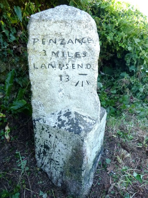
Image: © Rosy Hanns Taken: 4 Jul 2019
Carved stone post by the A30, in parish of LUDGVAN (PENWITH District), Ludgvan Leaze, West of Crowlas; West End of Marazion, view of St Michael's Mount, in the hedge, on South side of road. Hayle facets, erected by the Hayle Bridge Causeway turnpike trust in the 19th century. Inscription reads:- : PENZANCE / 3 MILES / LAND'S END / 13 : : HAYLE / 5 MILES / CAMBORNE / 11 / REDRUTH / 17 / TRURO / 23 : Carved benchmark on the right of left face. Grade II listed. List Entry Number: 1327658 https://historicengland.org.uk/listing/the-list/list-entry/1327658 Milestone Society National ID: CW_PZCA03.
Images are licensed for reuse under creativecommons.org/licenses/by-sa/2.0
Image Location


Leaflet Map data © OpenStreetMap
Latitude
50.141022
Longitude
-5.484143