
Cycle infrastructure on Hadrian's Cycleway
Introduction
The photograph on this page of Cycle infrastructure on Hadrian's Cycleway by Oliver Dixon as part of the Geograph project.
The Geograph project started in 2005 with the aim of publishing, organising and preserving representative images for every square kilometre of Great Britain, Ireland and the Isle of Man.

There are currently over 7.5m images from over 14,400 individuals and you can help contribute to the project by visiting https://www.geograph.org.uk
Cycle infrastructure on Hadrian's Cycleway
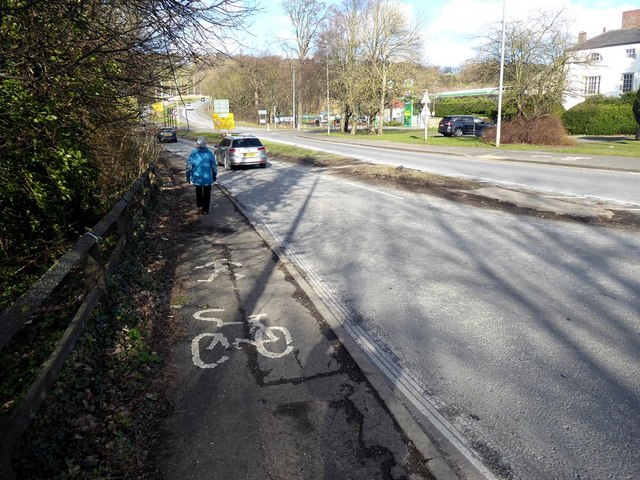
Image: © Oliver Dixon Taken: 27 Feb 2020
After crossing Hexham Bridge, Hadrian's Cycleway (National Cycle Network route 72) turns right across the main Rotary Way into Ferry Road. To "assist" cyclists making this turn, some very substandard infrastructure has been put into place. This involves diverting cyclists on to the footway for a few metres and then crossing Rotary Way by way of a cut over the central reservation before turning back on the footway on the far side. The poor nature of the facility and the part-worn paint markings are unlikely to help cyclists much if at all.
Images are licensed for reuse under creativecommons.org/licenses/by-sa/2.0
Image Location

Latitude
54.978041
Longitude
-2.093712