Whitlees Bastle (Elsdon)
Introduction
The photograph on this page of Whitlees Bastle (Elsdon) by Les Hull as part of the Geograph project.
The Geograph project started in 2005 with the aim of publishing, organising and preserving representative images for every square kilometre of Great Britain, Ireland and the Isle of Man.

There are currently over 7.5m images from over 14,400 individuals and you can help contribute to the project by visiting https://www.geograph.org.uk
Whitlees Bastle (Elsdon)
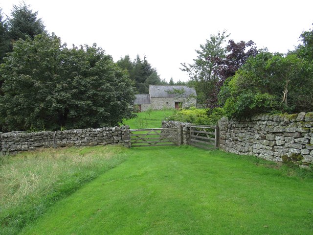
Image: © Les Hull Taken: 14 Aug 2019
One of the buildings on Whitlees farm seems to be a late 16th or early 17th century strong house. It has many characteristics of a bastle, such as walls built of massive stones and a boulder plinth, as well as walls over 1.3m thick. However, there is no trace of a barrel vault and for this reason experts consider it is not a true bastle. This is a Grade II Listed Building protected by law. http://www.keystothepast.info/article/10339/Site-Details?PRN=N9780
Images are licensed for reuse under creativecommons.org/licenses/by-sa/2.0
Image Location
Latitude
55.227781
Longitude
-2.0649