The Haining (Elsdon)
Introduction
The photograph on this page of The Haining (Elsdon) by Les Hull as part of the Geograph project.
The Geograph project started in 2005 with the aim of publishing, organising and preserving representative images for every square kilometre of Great Britain, Ireland and the Isle of Man.

There are currently over 7.5m images from over 14,400 individuals and you can help contribute to the project by visiting https://www.geograph.org.uk
The Haining (Elsdon)
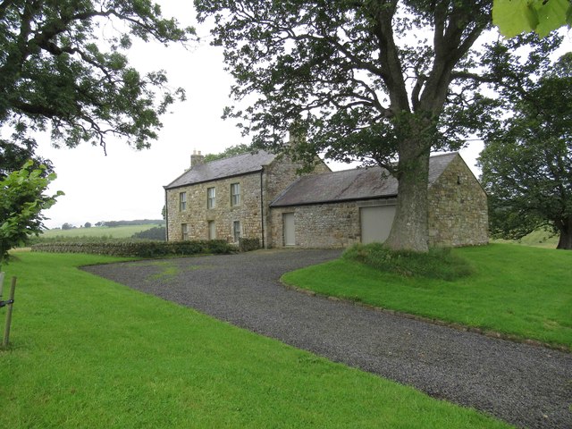
Image: © Les Hull Taken: 14 Aug 2019
A photo http://www.keystothepast.info/article/10339/Site-Details?PRN=N9772 taken in the 1960s shows that the building still had a roof then, but photos on Geograph taken in 2009 http://www.geograph.org.uk/gridref/NY9292?takenyear=2009 show it as a total ruin. What a transformation - I assume a holiday let? "The derelict remains of a small 17th-century farmstead called The Haining stand west of Elsdon village. The earliest documentary record of the farm is in 1663 and it also appears in later 17th-century parish registers. The farmhouse was probably built in about 1650 and is a typical Northumbrian pattern, being only one rook deep. It has a central door leading into a lobby with a room each side, a flight of stair lead to the first floor which is a single large room." http://www.keystothepast.info/article/10339/Site-Details?PRN=N9772
Images are licensed for reuse under creativecommons.org/licenses/by-sa/2.0
Image Location
Latitude
55.228638
Longitude
-2.119614