Former parish church [5]
Introduction
The photograph on this page of Former parish church [5] by Michael Dibb as part of the Geograph project.
The Geograph project started in 2005 with the aim of publishing, organising and preserving representative images for every square kilometre of Great Britain, Ireland and the Isle of Man.

There are currently over 7.5m images from over 14,400 individuals and you can help contribute to the project by visiting https://www.geograph.org.uk
Former parish church [5]
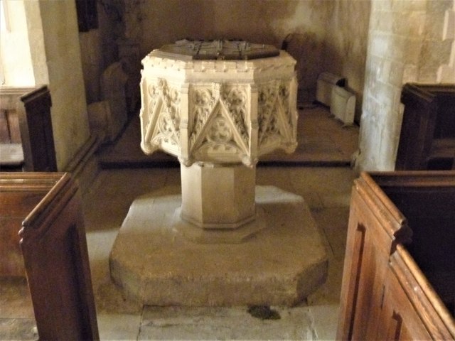
Image: © Michael Dibb Taken: 29 Jan 2020
The font is dated 1846. The former Anglican parish church for the parish of Maddington, St Mary's, has parts from the 13th, 14th and 15th centuries but was mostly rebuilt in 1637. There were two restorations in the 1840s. The church ceased to be used in 1976 and is now maintained by the Churches Conservation Trust. Listed, grade II*, with details at: https://historicengland.org.uk/listing/the-list/list-entry/1023959 The village of Shrewton is located on Salisbury Plain and is made up of several early communities and was, until 1934 three separate parishes. The name Shrewton comes from the Old English word for sheriff’s farm or settlement. The village lies on the east to west road from London to Bridgwater via Amesbury and Warminster. The River Till which rises near Tilshead flows through the village on its way to join the River Wylye near Stapleford.
Images are licensed for reuse under creativecommons.org/licenses/by-sa/2.0
Image Location
Latitude
51.193113
Longitude
-1.905645