Chitterne houses [16]
Introduction
The photograph on this page of Chitterne houses [16] by Michael Dibb as part of the Geograph project.
The Geograph project started in 2005 with the aim of publishing, organising and preserving representative images for every square kilometre of Great Britain, Ireland and the Isle of Man.

There are currently over 7.5m images from over 14,400 individuals and you can help contribute to the project by visiting https://www.geograph.org.uk
Chitterne houses [16]
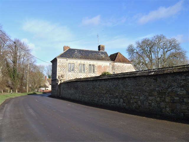
Image: © Michael Dibb Taken: 29 Jan 2020
Seen here from the road to the south, The Gatehouse is late 16th and late 17th century with 20th century alterations. The building is a mixture of chequered limestone and flint, brick and timber framed. The timber framed 16th century part is possibly the remains of a larger wing. Some original internal features remain. The listing includes the gate piers and the wall which is integral with the 17th century build. Listed, grade II*, with details at: https://historicengland.org.uk/listing/the-list/list-entry/1364348 Chitterne village lies in the middle of Salisbury Plain. Much of the parish is owned by the Ministry of Defence within the Salisbury Plain Training Area. The Imber firing range is to the north and the Copehill Down training area to the east. The Chitterne Brook, a small tributary of the River Wylye, flows through the village. There is a fine history of the village at: http://www.chitterne.com/history/index.html
Images are licensed for reuse under creativecommons.org/licenses/by-sa/2.0
Image Location
Latitude
51.197107
Longitude
-2.013403