Cancelled and inverted benchmark on outbuilding at Powis Cottages
Introduction
The photograph on this page of Cancelled and inverted benchmark on outbuilding at Powis Cottages by Luke Shaw as part of the Geograph project.
The Geograph project started in 2005 with the aim of publishing, organising and preserving representative images for every square kilometre of Great Britain, Ireland and the Isle of Man.

There are currently over 7.5m images from over 14,400 individuals and you can help contribute to the project by visiting https://www.geograph.org.uk
Cancelled and inverted benchmark on outbuilding at Powis Cottages
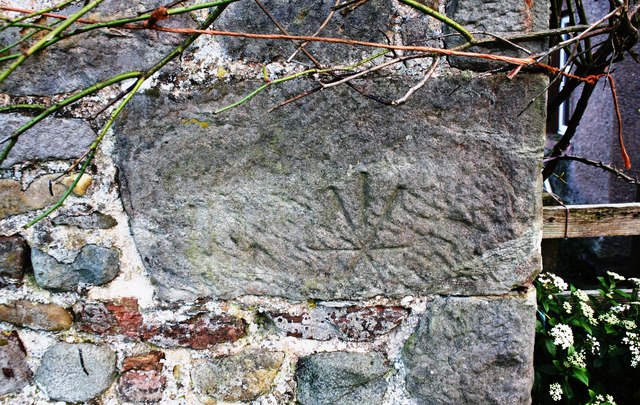
Image: © Luke Shaw Taken: 4 Feb 2020
The stone with this Ordnance Survey benchmark has presumably been reused, moved from the location where the mark was cut. Further information can be found at www.bench-marks.org.uk/bm93846
Images are licensed for reuse under creativecommons.org/licenses/by-sa/2.0
Image Location
Latitude
54.607434
Longitude
-2.541046